Sink, Swim, Float.
just don't rain.

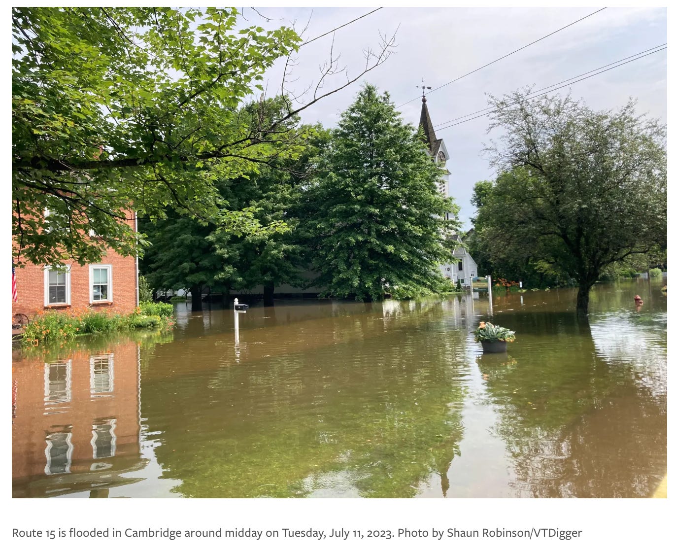
A year ago Vermont was underwater. I know, you know. The grief of it lingers in that tiresome, cyclical way. As does the physical destruction and permanent damage stretching across the state. Now somehow, exactly a year to the day from the worst of the flooding, we’re staring at screens alerting us of dangerously heavy rains.
Thunderclouds roil over sticky green mountains and are expected to fully unleash by nightfall. The only breeze is from the wake of mosquitos and black flies, swarming ad nauseam. I slink around my house as if to not wake a baby. Please keep sleeping. If you do wake, let it be without wailing.
In 2020, ProPublica rated our very own Lamoille County the lowest in the nation for vulnerability to the impacts of climate change. Of the 10 lowest ranking counties, Vermont’s 14 took up six spots. Determining criteria included heat and wet bulb temperatures, farm crop yields, sea level rise, large fires, and economic damages; counties ranked 1-10 in each with a 10 being the worst score.
The greatest risk of climate change, they noted, was “compounding calamities” like sea level rise combined with higher wet bulb temperatures. Or decreased farm crop yields as wildfires intensify, as is expected to increasingly occur in the southwest. Lamoille’s highest risk was rated a 2 for economic damages.
The data quickly circulated throughout Vermont in 2020, serving as additional justification for the Covid transplants who uprooted from Boston and New York to old dairy farms without wifi, bought sight unseen. In 2023, the research made new rounds, stark messaging contrasted against the bed sheet I saw tied to someone’s front porch—“FEMA WHERE ARE YOU” spray painted across it in red block letters.
The worst part of this information is that it just might be right. In the scope of regions juggling calamities, Vermont may emerge with some of the fewest compounding. The ones we have, however, still sting.
We’re broaching a collective retraumatization as we head into what may be another natural disaster (or may blow over as just another heated July thunderstorm). A year in, we’ll test our climate and emotional resiliency: How our preparation, government funding, and infrastructure holds up. We’ve long since blown by any quick fixes, though a tangible one could be continuing to update FEMA mapping to include forecasted flood data based on factors like climate change and sea level rise, as opposed to only drawing from historical data. It’s a process underway but incomplete, and rural, mountainous places prove especially difficult to map.
Thunder reverberates outside, and for now we’ll settle in for the night. We can assess our rating in the morning.